Event date
September 13, 2024
Cartagena de Indias, Colombia
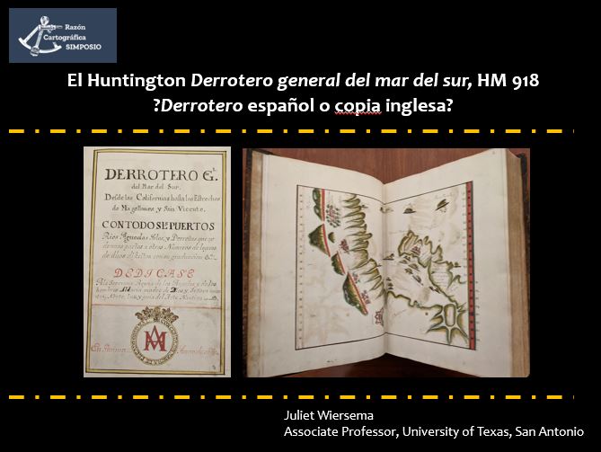
In the collections of the Huntington Library in San Marino, CA, is a large atlas, the Derrotero general del mar del sur, whose 149 charts depict detailed coastal renderings of the Pacific Ocean, from Cabo San Lucas to Tierra del Fuego. Made by hand, with a dateline “Panama, 1669,” this book of Spanish sea charts was initially proposed to be the derrotero seized by the English pirate, Bartholomew Sharpe, during his 1681 capture of the Spanish vessel, the Rosario, off the coast of Ecuador (Shulz, Cutherbert, and Noya 1962).
More recent scholarship has proposed that HM 918 may, instead, be the derrotero taken by the English pirate Henry Morgan during his sack of Panama a decade earlier, in 1671 (Howse and Thrower 1992: 263-264).
But, what if HM 918 is not what it purports to be: an atlas produced by Spanish navigators in the Audiencia of Panama in 1669? What if instead it is an English copy of a Spanish derrotero, produced by chart makers in London or in the English-held territory of Jamaica?
The discovery of a very similar derrotero (Ms 221) in the Society of Antiquaries in London helps to highlight some of the Huntington derrotero’s anomalies, including textual errors and watermarks that are inconsistent with paper in circulation in Spain’s colonies.
How might a reattribution of HM 918 alter its own history as well as our understanding of elaborate, presentation-style derroteros produced during the late seventeenth century as England was making incursions into Spanish seas?